


Newark Changing is an interactive visual encyclopedia featuring 2,400 photo comparisons from 1959-68 vs. today. The project illustrates the combined impacts of urban renewal, slum clearance, highway construction, and decades of demolition by neglect. Through a historic map, users can explore dozens of neighborhoods and thousands of demolished homes. This research highlights the devastation faced by communities due to decades of anti-urban policy decisions by the government and anti-black investment decisions by corporations.
As published by Newark Public Library. Visit: NewarkChanging.org/map VIEW PUBLICATION >
This is the official history map and guide for visitors to Branch Brook Park in Newark, NJ. This 360-acre park was designed by Frederick Law Olmsted Jr in the 1890s and is on the National Register of Historic Places.
Navigate this interactive map to learn about park amenities, recreational spaces, historic sites, transit connections, points of interest like the cherry blossoms, and vanished landscape features from Olmsted’s original plans. Map annotations are paired with explanatory texts and comparative photos of past and present.
Official park map as published by Branch Brook Park Alliance and Essex County government VIEW PUBLICATION >
The historic 1890s Warren Street School stood in Newark’s University Heights neighborhood and served a century of public school children. Despite its landmark status and eligibility for future inclusion on the National Register of Historic Places, Newark City Hall approved demolition on April Fool’s Day in 2021. This demolition highlights the New Jersey Institute of Technology’s calculated disregard for architectural heritage. The demolition act also symbolizes a broader trend of city leadership that is ignorant of history and the power of historic preservation to cultivate local identity. VIEW PUBLICATION >
The New Jersey Institute of Technology (NJIT) faces criticism for demolishing historic buildings in Newark’s James Street Commons Historic District. While NJIT invested significantly in architecture for its students, the parts of campus that face toward the city and commmunity lack community engagement and negatively impact urban aesthetics. I advocate for campus planning that enhances neighborhood life and preserves historical assets. VIEW PUBLICATION >
This workshop organized by The Architectural League of New York emphasized the need to reinvent architecture and urban planning in light of the conjoined crises of COVID-19 and climate change. The workshop aimed to bring young professionals together to discuss how to adapt spaces and infrastructures to evolving societal needs, reducing reliance on traditional commuting and repurposing abandoned sites to more sustainable land uses than just surface parking and highways. VIEW PUBLICATION >
The untimely and short-sighted demolition of old Penn Station in 1963 symbolizes the eroding quality of public space in New York City. In the conflict between developers and community voices in New York, the narrow considerations of economic profit triumphed over the broader community’s demands for historical preservation and high-quality public space. In this essay written for historian Evander Price’s summer 2020 class I took at Harvard University, I reflect on what the loss of this landmark reflects about the destructive nature of American capitalism. VIEW PUBLICATION >
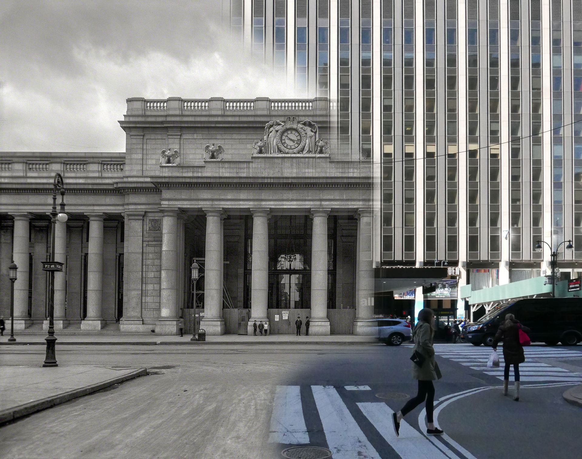
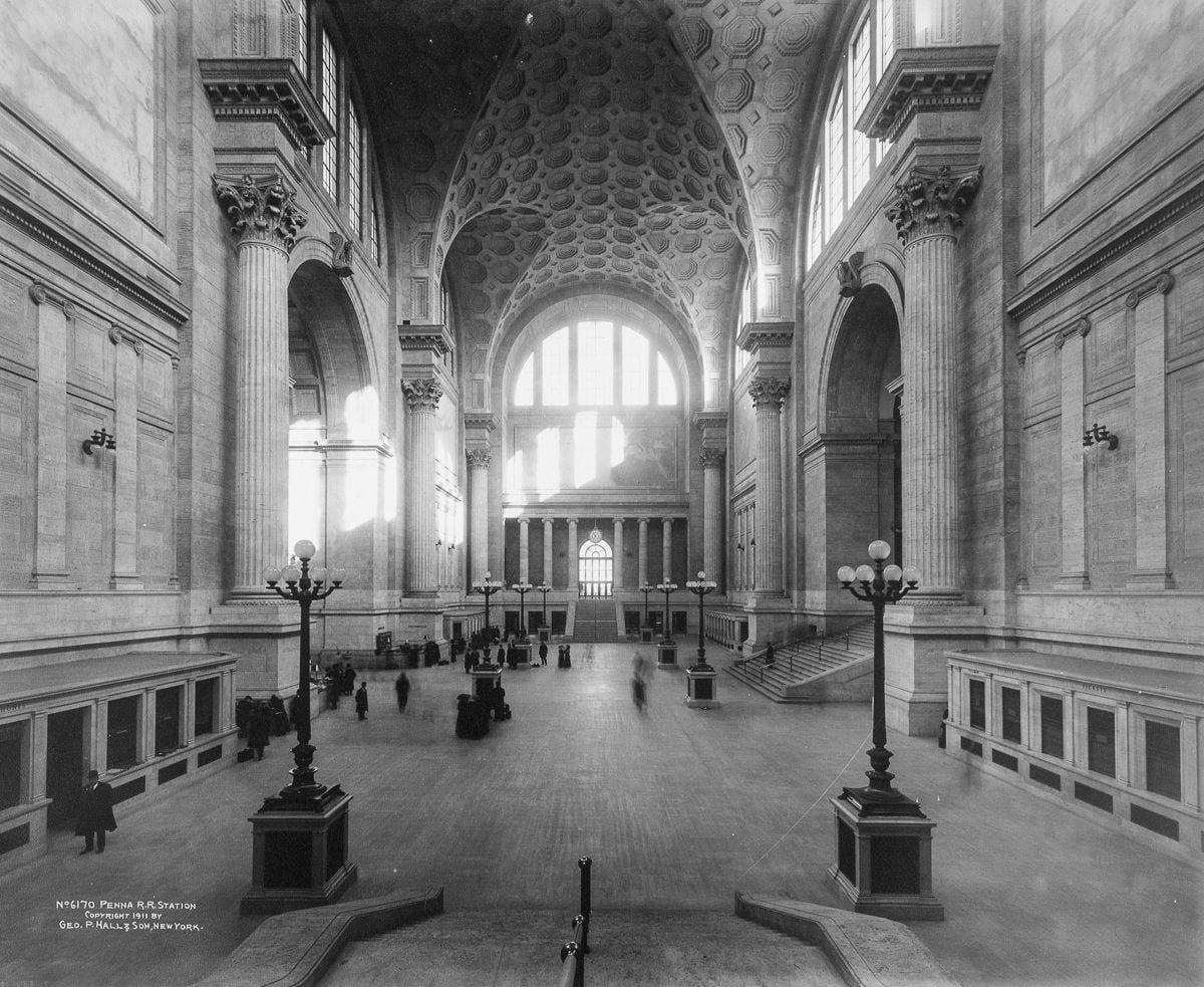
In this computer model and series of image comparisons of past and present, I walk viewers through New York Penn Station. I identify the current and contemporary camera angles from which historical photos were taken in 1911.
The accompanying historical essay explores the historical significance and transformation of this trains station. Originally a grand architectural masterpiece from 1910 that embodied neoclassical design and values, the station was demolished in the 1960s, in order to build a modern structure that lacks its predecessor’s grandeur. VIEW PUBLICATION >
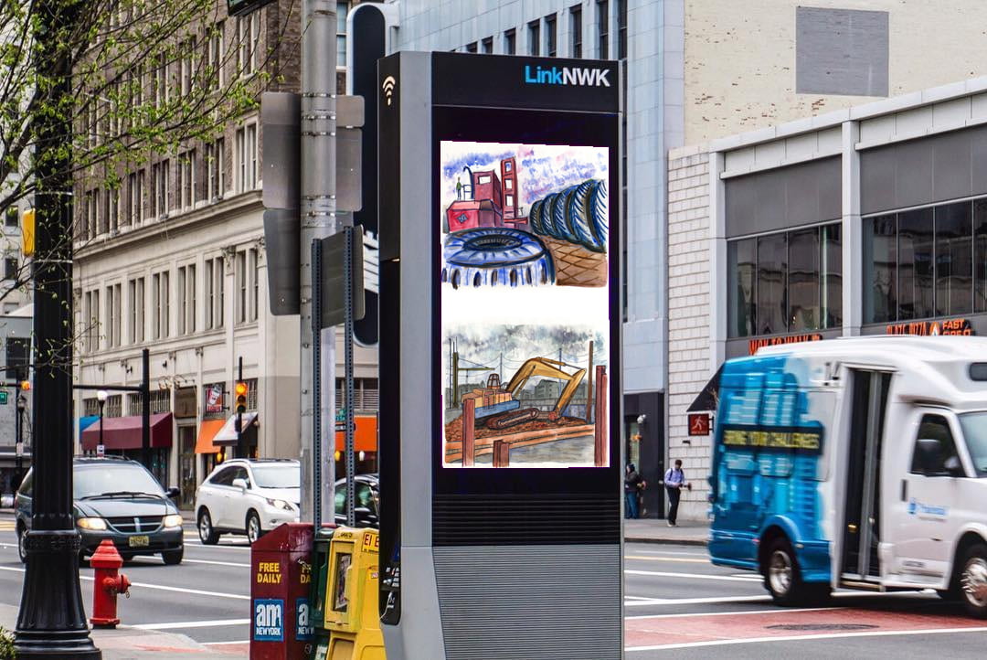
In fall 2019, LinkNWK, the company that manages free wifi hotspots and advertising screens in downtown Newark, invited me to display my artwork on their kiosks. I selected several dozen of my artworks and images that document the demolition of historic neighborhoods and the demolition of community spaces. VIEW PUBLICATION >

Here are a few of my digital models that can be explored in virtual reality. Cathedrals. Mosques. Prisons. Dream houses. VIEW PUBLICATION >
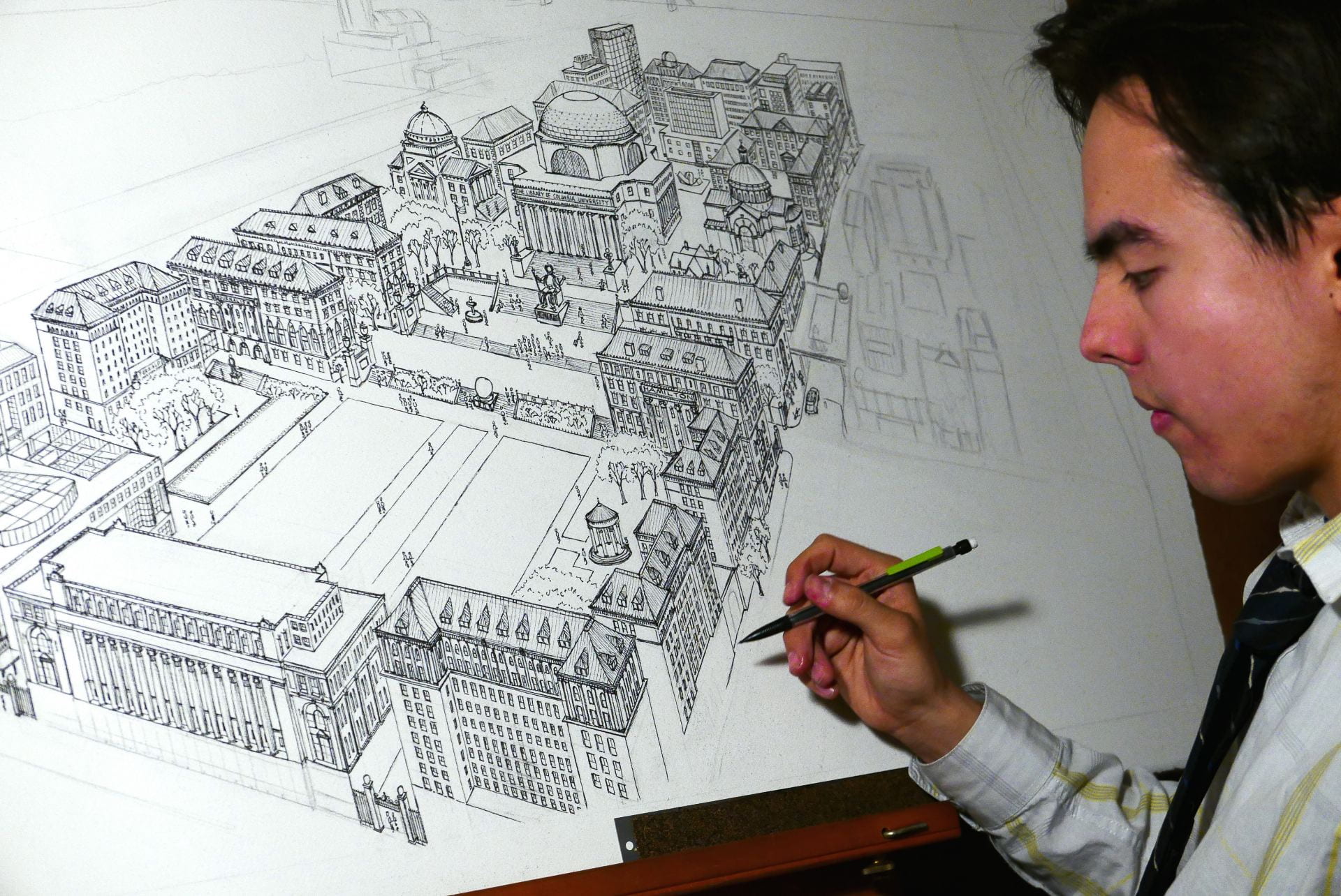
This digital portfolio highlights various artistic projects, time-lapse drawings, and models I created of Columbia University’s campus, during the time I was a student there. The portfolio features a detailed ink and watercolor campus drawing, a mini model of the campus made from paper, and six time-lapse sequences documenting artistic processes. Featured in multiple publications, these creations are now a personal souvenir of my education at Columbia.
Contact me to download source files or to order custom prints mailed to your home address. VIEW PUBLICATION >
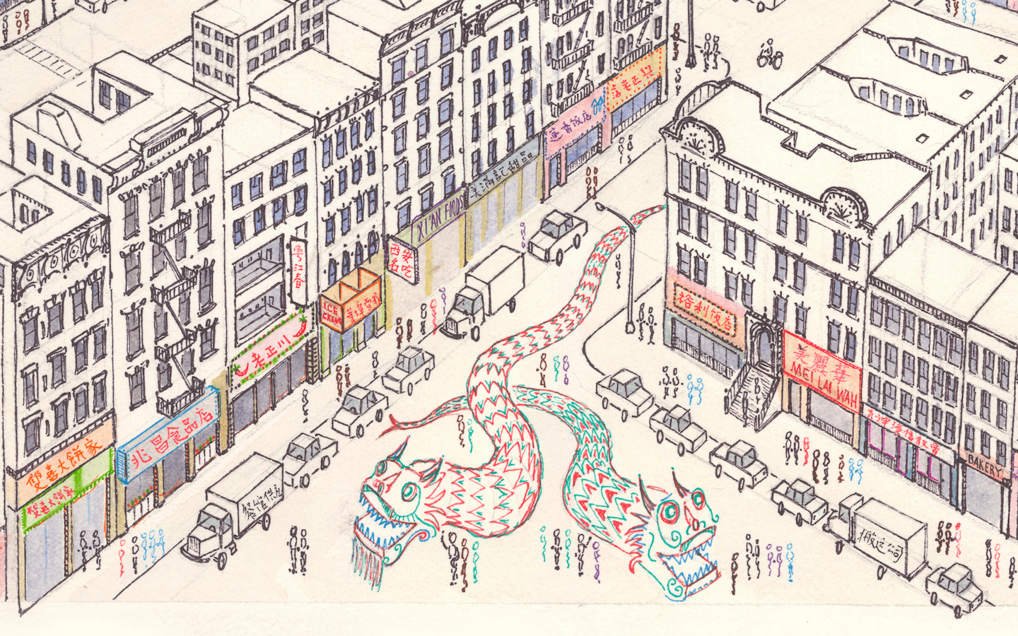
This time-lapse of Manhattan Chinatown took sixty hours to complete and measures 26 by 40 inches. The artwork features Chinatown’s tenements in the foreground, with Lower Manhattan’s skyscrapers towering above.
Drawing is shared online in lower resolution. Email me for the full-size file. Custom size prints will be mailed to your home address on request. VIEW PUBLICATION >
This exhibit created for the Newark Public Library uses postcard comparisons of past vs. present to showcase Newark’s architectural evolution from 1916 to today. The project highlights the loss of cultural heritage due to urban renewal and demographic change. The resulting interactive map presents 150 comparative views, which illustrate the progressive loss of human-scale small structures that were central to the city’s vanished neighborhood identity. VIEW PUBLICATION >
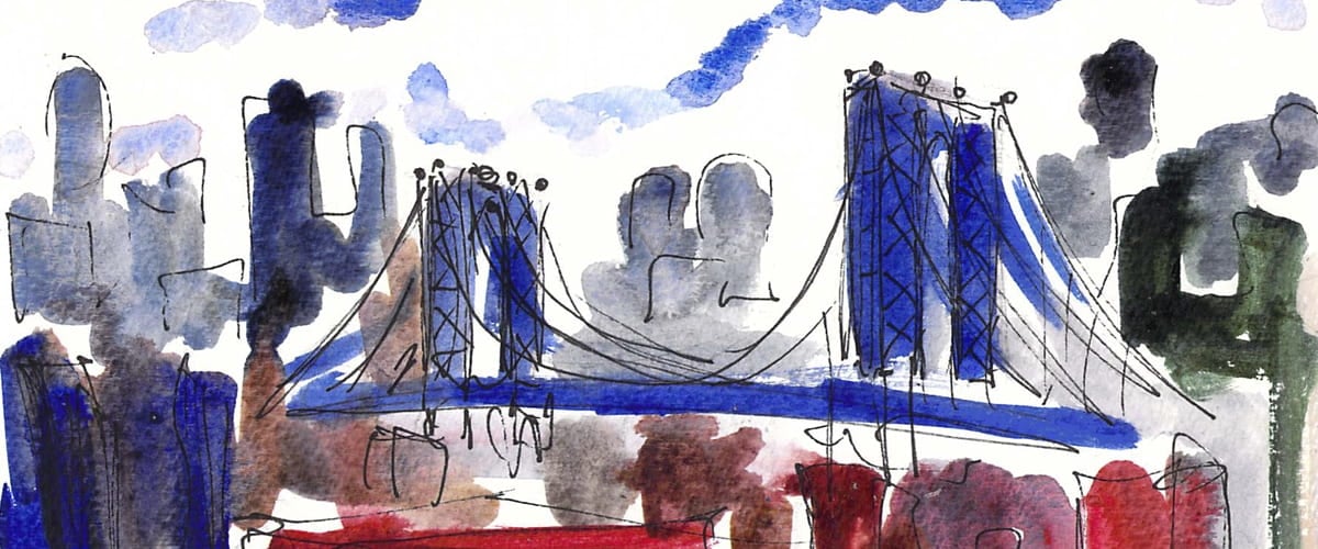
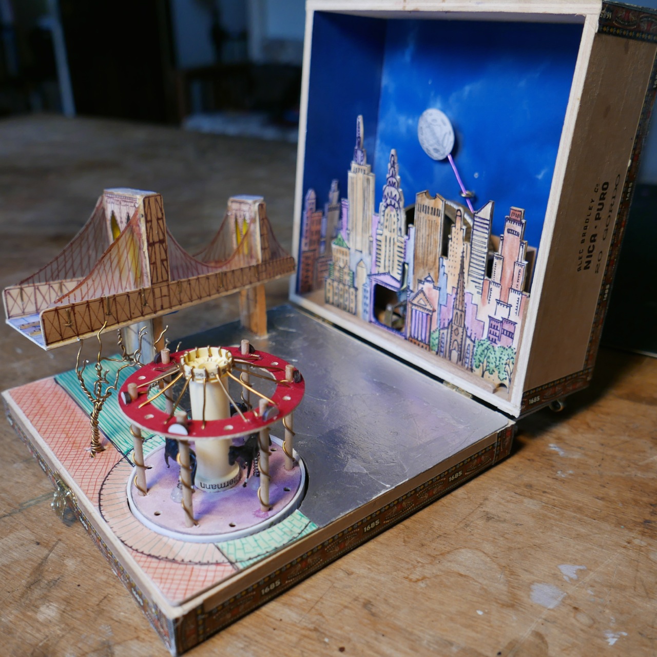
A wind-up music box featuring Jane’s Carousel along the Brooklyn Waterfront. When closed, the antique cigar box measures a mere 7 by 7 inches and 3 inches deep (18 x 18 x 8 cm). When opened, the Brooklyn Bridge and historic Jane’s Carousel fold out. The carousel spins to the tune of the music while the moon slides across the night sky. VIEW PUBLICATION >
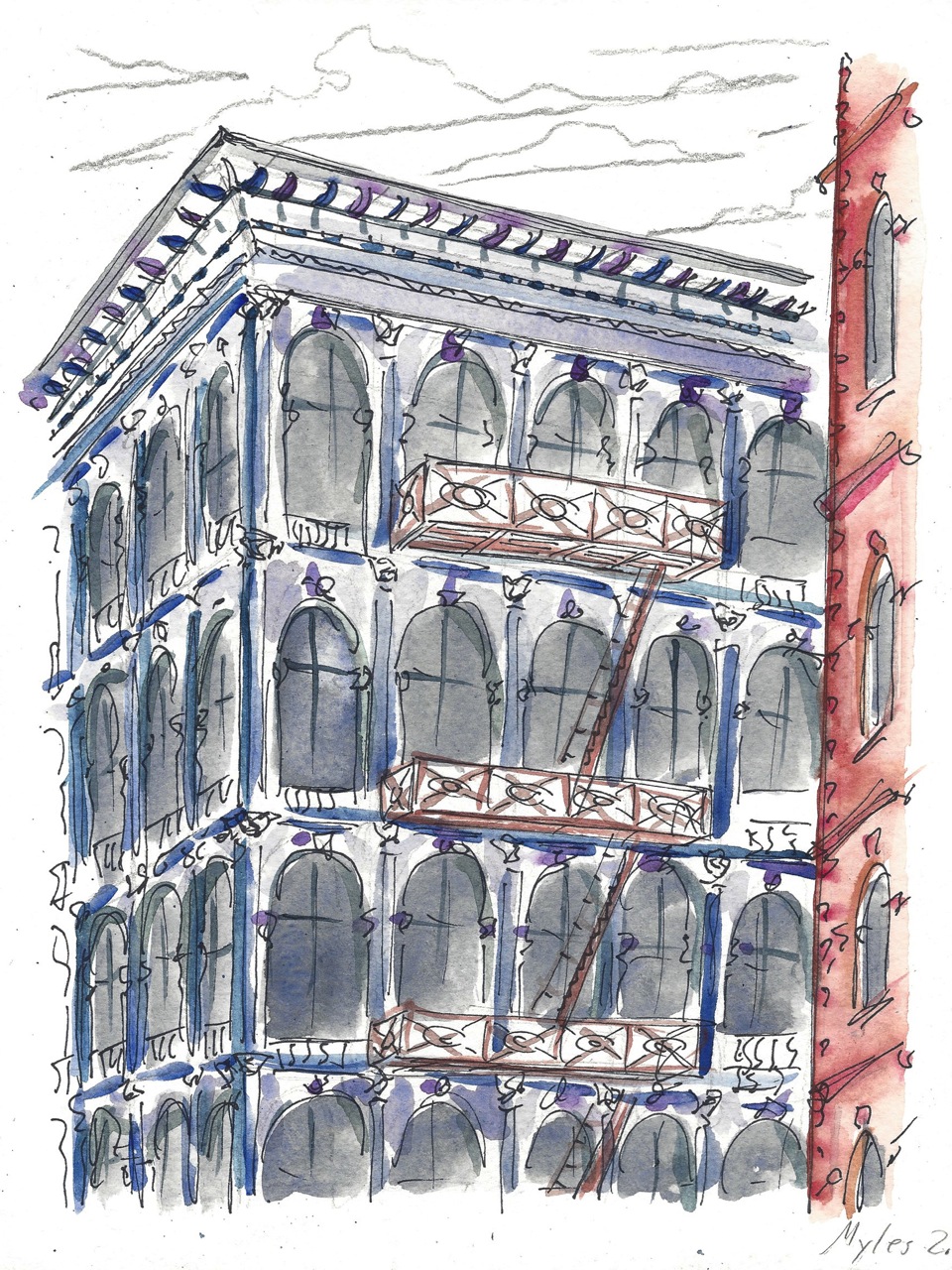
This project features a portfolio gallery of my drawings, watercolors, paintings, and photographs of Manhattan island. The portfolio is divided into ten “walks” over the chapter structure of ten “days.” Each “day” features some of my artwork about a different neighborhood of Manhattan: Chinatown, SoHo, East Village, West Village, the High Line, Madison Square, Midtown, Central Park, Riverside Drive, Morningside Heights, Harlem, and Washington Heights. VIEW PUBLICATION >
Murphy Varnish, built in 1886, is one of Newark’s oldest factories still standing. Its brick walls, terracotta ornament, and intricate brickwork reflect a time when industrial structures were more than just functional. Murphy Varnish reflects a time when industry was central to Newark’s wealth and key to its future success. It is a monument to industry, built to last. Recent renovation efforts promise to turn this derelict structure into a community of apartments. VIEW PUBLICATION >
Vanishing City is a visual documentary and photo essay about architecture and redevelopment in Newark. An abandoned barge sinks in murky waters. A former factory tumbles before the wrecking ball. A sea of weeds lays siege to a vacant home. An empty lot is a gaping hole, a missing tooth, in the urban body. As a wall crumbles to the ground, a tree, anchored to the wall, reaches for the sky. VIEW PUBLICATION >
I spent much of the past few years painting and photographing my changing city. This short film features a selection of my work, complemented by classical music. Five of Modest Mussorgsky’s pieces from his composition Pictures at an Exhibition are selected, each of which represents the feel of a certain part of Newark. VIEW PUBLICATION >
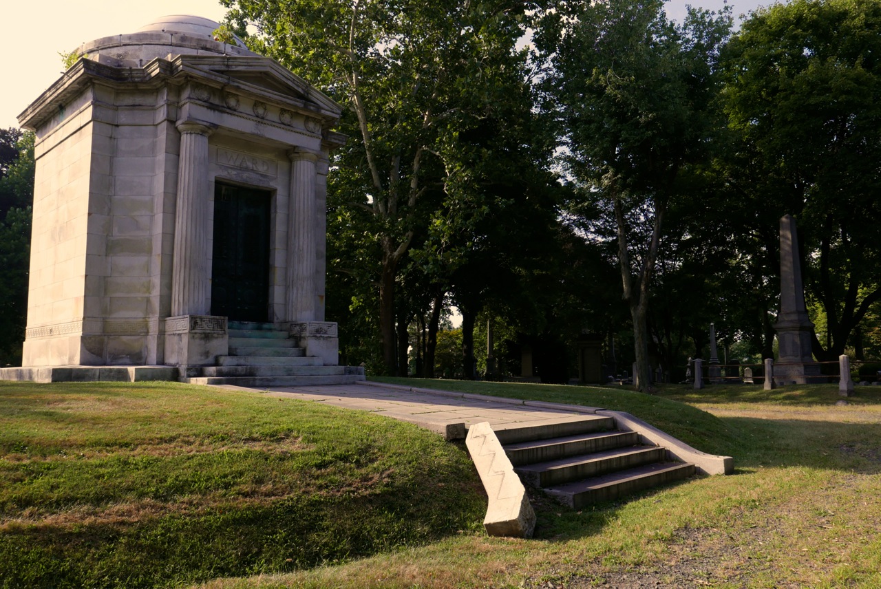
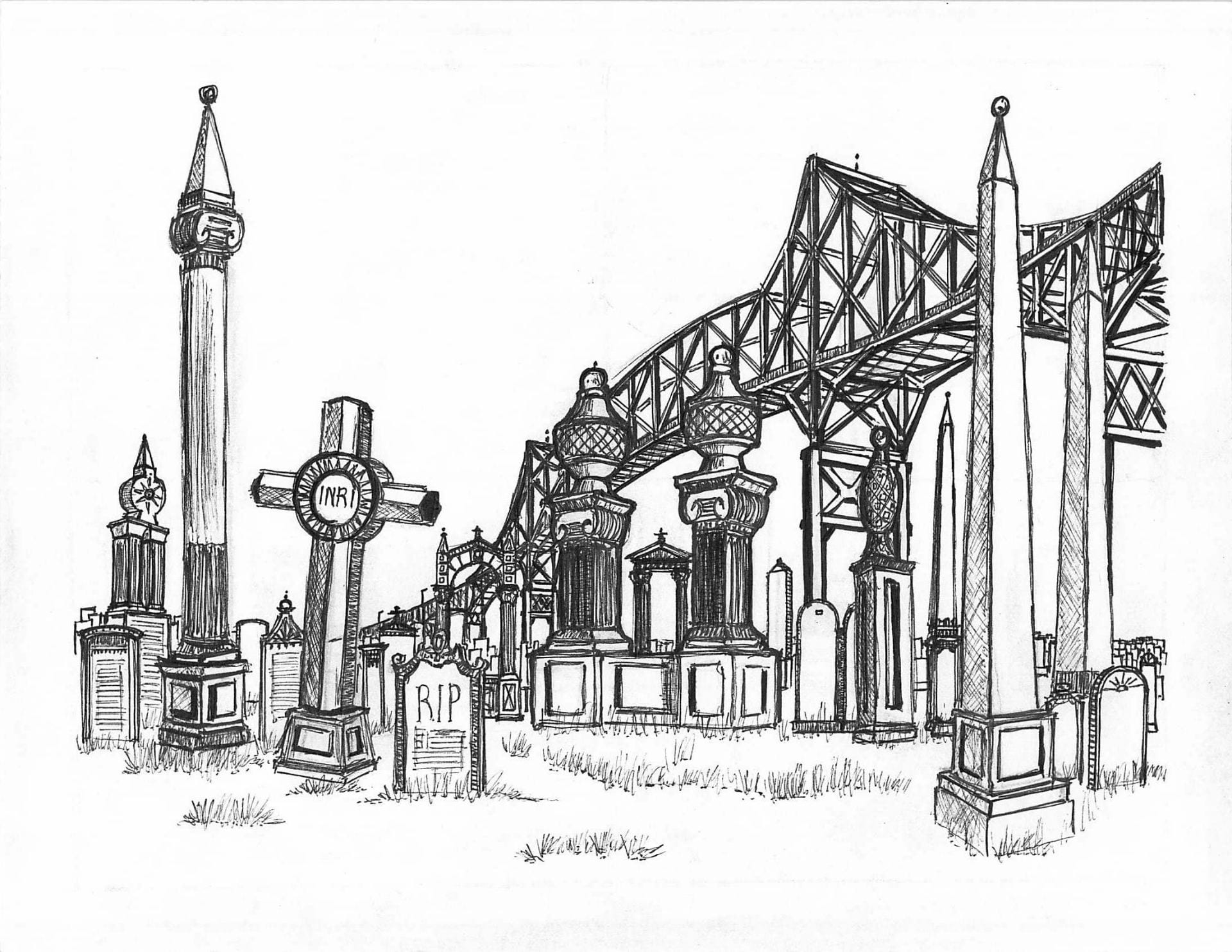
Mount Pleasant was the resting place of Newark’s leading industrialists, politicians, and first families. Opened in 1844 and landmarked in 1988, it fell into neglect as Newark’s wealth flowed away to foreign factories and Newark’s people fled to suburbia. Memories and histories carved in the text of century-old tombstones erode away as slowly as murky waters flow past in the nearby Passaic River. VIEW PUBLICATION >
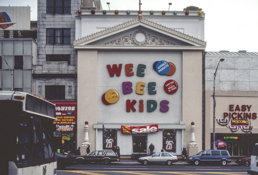
Growing up in Newark, I was inspired and saddened by my inner-city environment: I am inspired by Newark’s hope of renewal after decades of white flight, under-investment, and urban neglect. I am saddened by the loss of my city’s historic architecture and urban fabric to the wrecking ball of ostensible progress. My photo and art series titled Renaissance City depicts the Newark of my childhood with garish signage and decayed structures blanketing the city in a medley of color and consumerism. VIEW PUBLICATION >
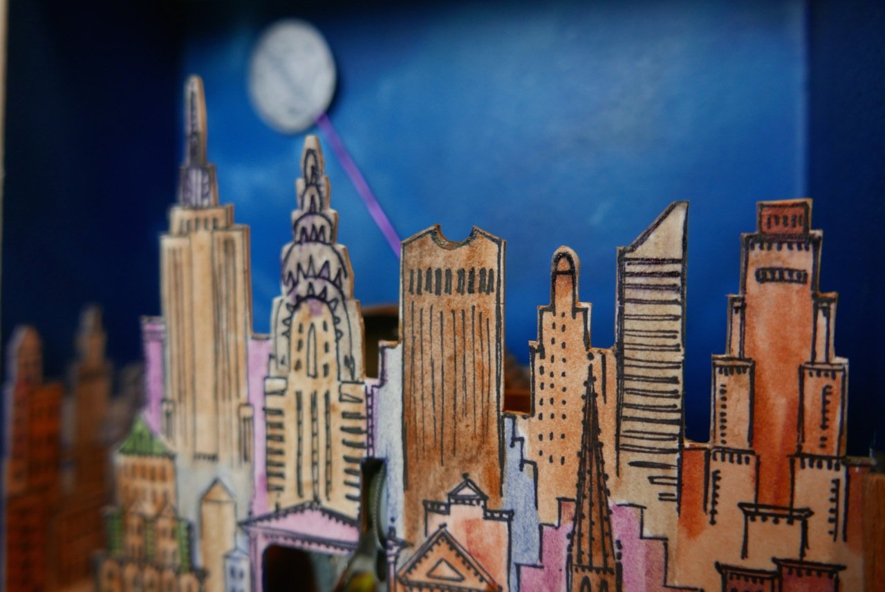
In the summer of 2014, I built a model of New York City containing many of the city’s landmarks, skyscrapers, and a flock of subway cars. This creation measures a mere 28 by 36 inches (70 x 90 cm) and is made of wood, paper, and plastic. VIEW PUBLICATION >
Dedicated to Professor of Economics Brendan O’Flaherty for helping me apply to Columbia as an undergraduate.
The following video lecture contains paintings and photos I compiled while walking in New York. VIEW PUBLICATION >
Excerpt from the Common App essay I wrote in 2015. This essay on the experience and love of walking accompanied my successful undergraduate application to Columbia University. VIEW PUBLICATION >
In this visual essay of drawings, paintings, and photos I explore my walks in Manhattan Chinatown. Chinatown is both static and dynamic: Static in its resilience against gentrification, dynamic in its cultural interplay between past and present, immigrant and American. VIEW PUBLICATION >
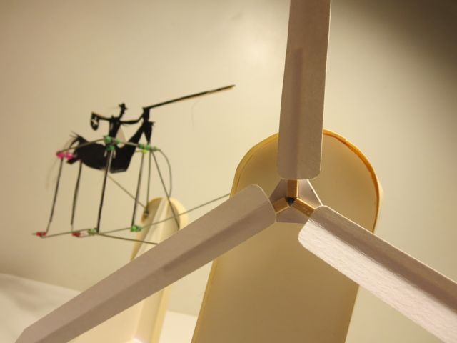
This series explores movement. These sculptures made of paper, wire, and wood are powered by the wind. When placed before a light breeze, the pinwheels spin and power the sculptures’ cyclical movements. The bird will soar. The horseman will charge forward, lance at the ready. Each sculpture evokes the theme of movement. VIEW PUBLICATION >
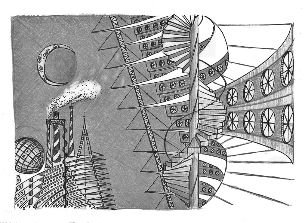
Space House is inspired from images of 1950s futurism and from architect Buckminster Fuller’s proposal for the ideal, modern home, the Dymaxion House. This circular model made of paper is three floors tall and fifteen inches in diameter. The house is painted silver, circular, and domed to evoke the streamlined images of 1950s American cars. VIEW PUBLICATION >
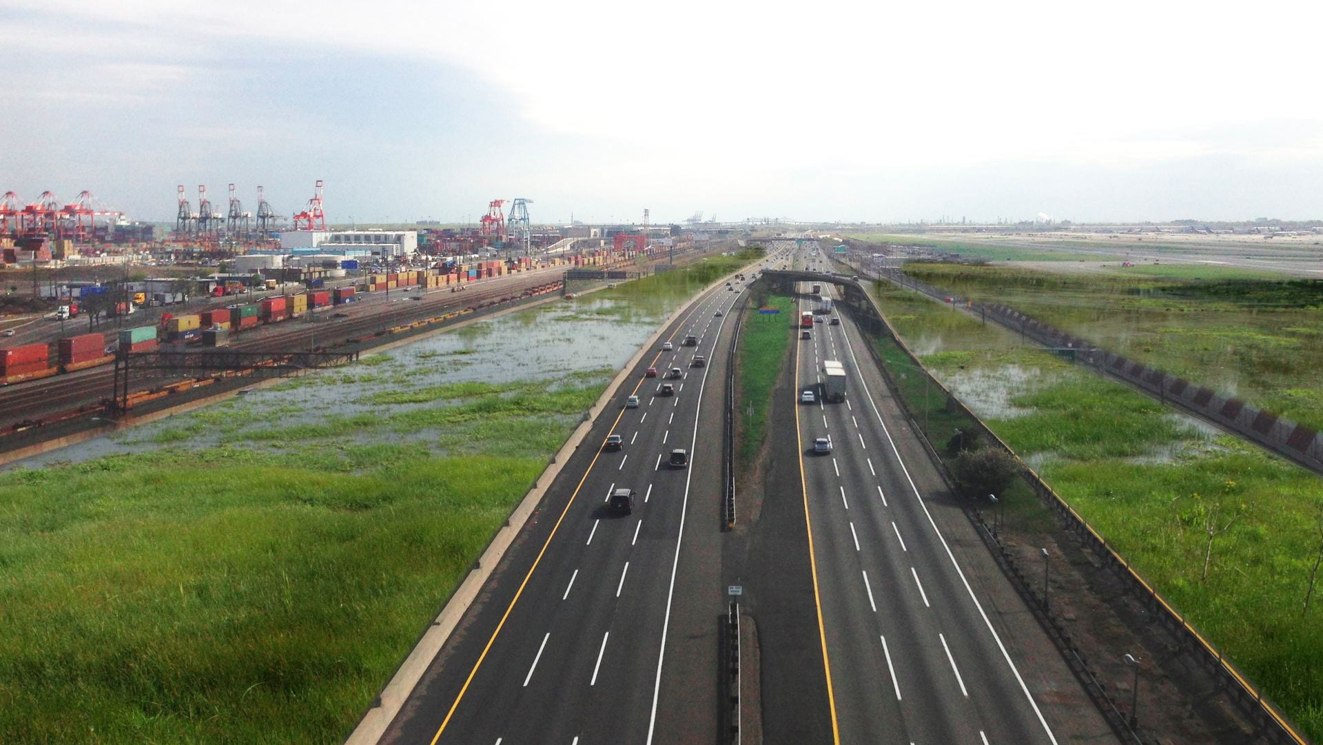
A visual essay of my photos and watercolor paintings. Work examines the themes of industrialization, decay, and mass production in the consumer landscape of warehouses and shipping docks at Port Newark. VIEW PUBLICATION >

A visual essay of artwork and photos from my experience of walking in the South Bronx.
Strolling in the Bronx, I am arrested by the inner-city grid that stretches mile after mile. Block after block, street after street, a never ending treadmill of bodegas, tenements, hair salons, C-TOWN supermarkets, strip malls, and laundries. In the treadmill of the city grid, I become an explorer lost wandering. I retrace my footsteps. VIEW PUBLICATION >
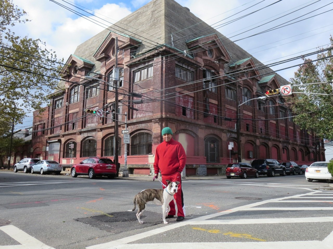
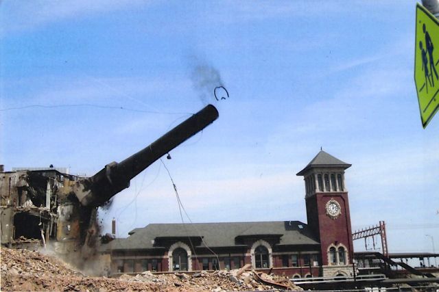
As featured by NJ.com in spring 2019 Update: Following a case filed by New Jersey Appleseed Public Interest Law Center on behalf of PLANewark, Edison Parking admitted that they demolished this building without seeking proper permission from city and state agencies. Edison was in negotations out of court with PLANewark about ways to mitigate the damage they caused. On a warm Sunday in August 2014, bulldozers started tearing away at a historic, turn-of-the-century loft space. Although the first floor was sealed with cinder blocks, the upper floor was adorned with large Chicago-style windows, intricate white terracotta carvings, and Greco-Roman ornament…. VIEW PUBLICATION >
A photo essay and artist’s statement about the geography of decline and landscape of abandonment in contemporary Detroit. VIEW PUBLICATION >