• This website includes dozens of videos, hundreds of essays, and thousands of drawings created over the past twenty years. Search to learn more about the history of buildings, places, prisons, Newark, New York City, and my PhD research on spatial inequality.

  • Or scroll down for the latest publications.

Interactive surface parking map of central Newark

Explore an interactive map of the 300+ acres of parking in Downtown Newark. This map is part of PLANewark’s ongoing fight against the expansion of surface parking in Newark. Click the rectangle icon on upper right hand corner of map to view full screen. Click on individual, color-coded lots to view information on the property owner and acreage.

.

Interactive map of Newark’s blight of parking

.

.

Destruction of the James Street Commons: 1975-2020

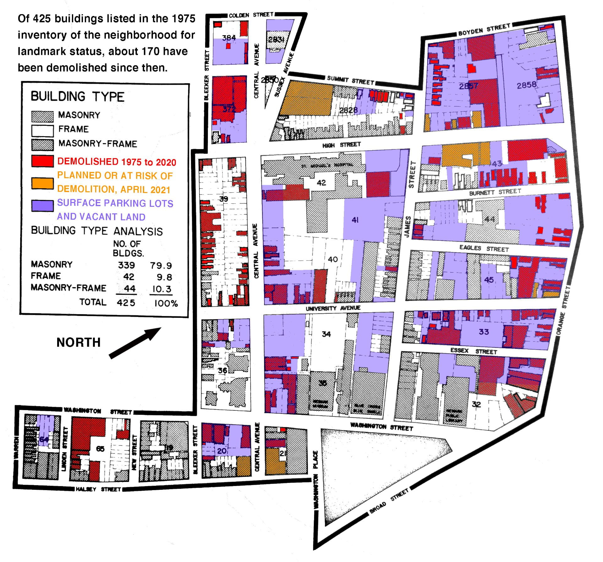
This map (accurate as of April 2021) illustrates buildings demolished in one Newark neighborhood, the James Street Commons. When historians first considered this neighborhood for landmark status in 1975, there were 425 historic buildings. Even after earning landmark status in 1978, demolitions and urban decay continued. Rutgers, Edison Parking, St. Michael’s Hospital, and the New Jersey Institute of Technology have demolished dozens of old buildings, mostly to construct surface parking lots as an “interim” land use. It is time that the local and state governments be more proactive in preserving the city’s history.

.

Bookmark the permalink.

Leave a Reply

Your email address will not be published. Required fields are marked *