As featured by City as Living Laboratory
And the Municipal Art Society of NY


Eldridge Street Synagogue and Manhattan Bridge
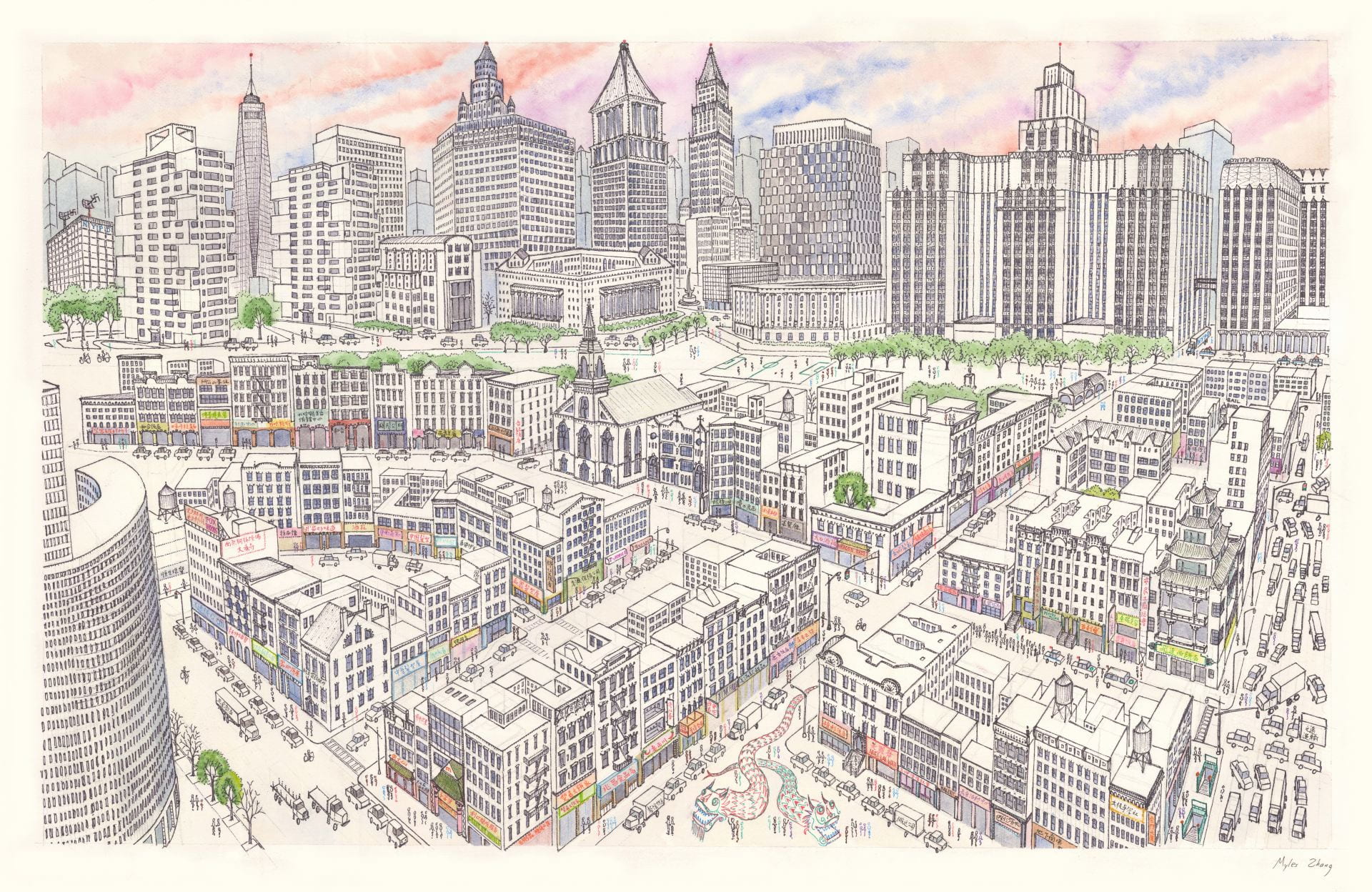
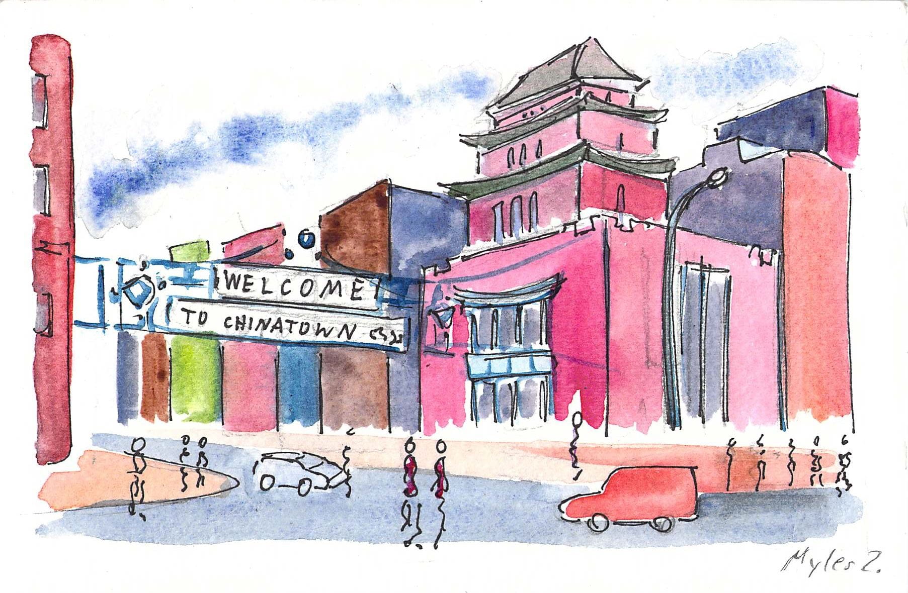
Welcome to Chinatown. With a population of ~150,000, this neighborhood is the largest ethnic Chinese community in the Western Hemisphere. Join us on a mile-long walk through space and time.
A few questions to keep in mind during our walk:
+ How has Chinatown changed over two centuries of urban growth? What has not changed?
+ What other cultures and ethnicities lived here before or simultaneously with the Chinese?
+ How are the challenges the Chinese faced imprinted on the built environment of Chinatown?
+ How does Chinatown street life blur the boundary between public and private space?
Interactive Tour Map
Thank you to Liza Cucco, Olivia Georgia, and Stephen Fan for co-creating this virtual tour. City as Living Laboratory has been exploring this neighborhood through walks for many years. A recent initiative explored issues of climate, equity, and health in Chinatown’s unique food system.
Tour Stops
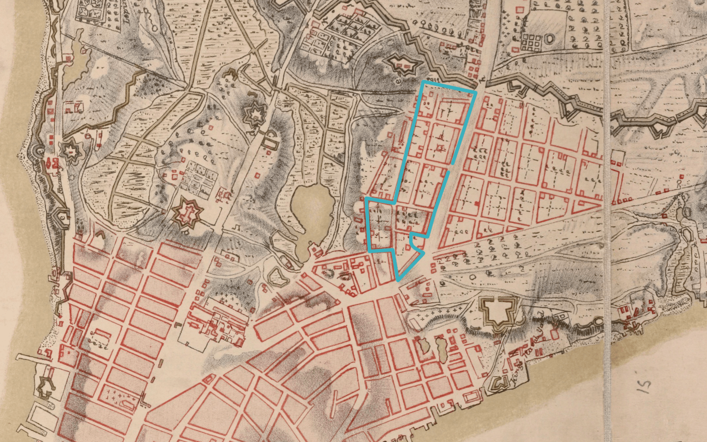
Route of walking tour superimposed over 1782 map of Manhattan
1. Bowery & Canal Street
Start at the southwest corner of Canal Street and Bowery, opposite the entrance to the Manhattan Bridge. The Bowery was a former Lenape trail turned dirt road linking Lower Manhattan to farms just north of where you are standing. Bowery comes from the word bouwerij in Dutch, or bower in English, meaning “a pleasant shady place under trees or climbing plants in a garden or wood.” Ironically, Lower Manhattan now has less green space per resident than most other parts of New York City.
Walk south on Bowery to our next stop at Pell Street.
2. Edward Mooney House
The four-story home built in 1785-89 has a sloped roof and ornamental details in the Federalist style that was popular around the time of the American Revolution. Edward Mooney, a wealthy butcher, built his house at the northern edge of Manhattan’s urban growth and within site of farms and rolling hills. It is the only surviving town house in Manhattan from the period of the American Revolution, and it is a reminder of past generations and land uses in Chinatown.
In 1790, New York City was capital of the United States and consisted only of Manhattan. The town had a population of 33,000, in contrast to 2.3 million in 1910. Chinatown and the Lower East Side ranked in 1910 as one of the densest places on earth with over 300,000 people per square mile. Manhattan’s population has fallen to 1.6 million, but imagine the streets three times as crowded.
With nineteenth-century revolutions in Germany, famines in Ireland, poverty in Italy, and organized massacres of Jews in Eastern Europe (called pogroms in Yiddish), immigrants arrived by the millions; Manhattan’s population swelled. The Chinese began arriving by ship in the 1820s and 1830s. By the 1850s, there were about 150 Chinese sailors in Lower Manhattan – most migrants hoping to make their fortune in America and then return home. Most Chinese immigrants to America spoke Cantonese due to the relative poverty of this region of China. Fleeing from the poverty of China to the promise of California, they found work on the Transcontinental Railroad. Fleeing the white nationalists and death threats of California, they sought refuge in New York. Wealthy merchants in houses like Edward Mooney’s moved north, away from the pestilence and crowded conditions of Lower Manhattan. In a few decades, the area transformed from a neighborhood of English-style townhouses for the middle classes and wealthy into the mass of tenements you now see.
3. Heading to Doyers Street
Walk down Pell Street to the intersection with Doyers Street. Notice the multi-story vertical signs that hang from the tenements. They are similar to the neon signs that clutter the streets of Hong Kong. Also notice the profusion of almost a dozen barbershops. As each generation of immigrants arrived in Manhattan, they brought with them the aesthetics and traditions of their homeland that were then integrated into the island’s streetscapes.
As you walk down Doyers Street, notice the eccentric curve of the road. Before the 1811 Manhattan grid standardized urban growth, individual landowners decided how best to divide and resell farmland for development. With no standard plan, Lower Manhattan grew organically as a crazy quilt of intersecting streets.


Pell Street and Doyers Street
4. Abacus Federal Savings Bank
As you approach Bowery again, notice the Chinese jewelry store to your right, one of many in the area. As immigrants in America, the Chinese were locked out of the financial system, denied home mortgages, and often relied on jewelry to symbolize and preserve wealth. Turn left and walk forty feet back up Bowery. You will see the Abacus Federal Savings Bank, founded by Chinese immigrants. In a gesture to the preferences of its immigrant customers, Abacus offers thousands of safe deposit boxes in its basement for the storage of jewelry and other valuables. Abacus was the only bank prosecuted after the 2008 financial crisis, and was later cleared of all charges by the jury’s unanimous decision. Manhattan District Attorney Cyrus Vance Jr., who is investigating Donald Trump’s taxes, charged Abacus with falsifying loan applications so that borrowers would qualify for home mortgages.
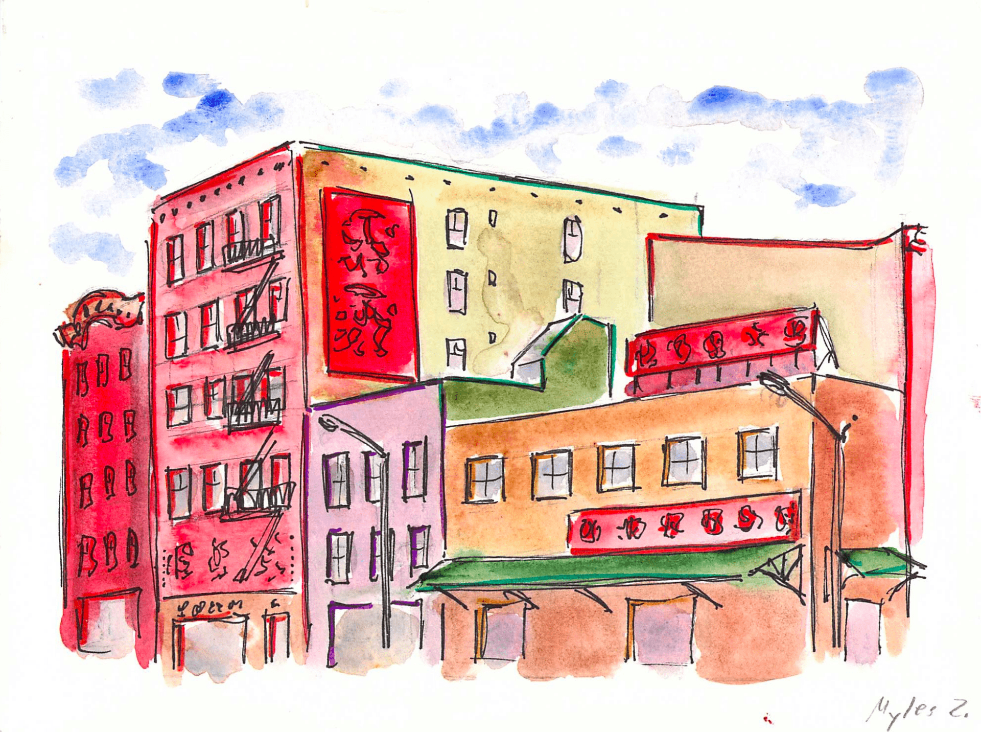
Chinatown businesses
5. Kimlau memorial gate
Across the street, you will see the Kimlau memorial gate commemorating Chinese-Americans who served and died in the US military. Behind the gate is a statue of Lin Zexu, a nineteenth-century Chinese scholar and official who fought and failed to stop British and colonial powers from smuggling drugs into China in the name of “free trade” and getting millions of Chinese addicted to opium. Before 1965 reforms to US immigration policy, generations of Asians served in the US military while their friends and family were prohibited from immigrating, marrying, or owning their own homes in the suburbs. Historian Mae Ngai characterizes America’s relationship with the Chinese as simultaneously wanting cheap products and foreign labor without suffering the presence of the people who sacrificed and labored for them.
6. Church of the Transfiguration / Wing on Wo & Co.
Walk down Bowery until you reach the intersection with Mott Street. Turn right and walk one block up Mott Street to the Church of the Transfiguration. At this site since 1801, it was first an English Lutheran church, and for a brief period in the nineteenth century a largely Irish church with a Cuban pastor. Later still, it became an Italian congregation. As Chinese replaced Italians as the neighborhood’s dominant ethnic group, the congregation became Chinese. Catholic masses are held in English, Mandarin, and Cantonese.
Across the street, you will find Wing on Wo & Co., the oldest continually-run family business in Chinatown. Its fifth-generation owner, Mei Lum, also runs the W.O.W. project, a community-based initiative that reinvents, preserves, and encourages Chinatown’s creative culture and history through arts, culture, and activism. W.O.W. hosted one of CALL’s 2018 workshops with artist Jean Shin.
Continue downhill along Mosco Street.


Photos of Mulberry Bend by Jacob Riis
7. Mulberry Street
Notice the several funeral homes along this stretch of Mulberry. As indicated by the century-old Baroque entrance of the Wah Wing Sang Funeral Corp., many funeral homes in Chinatown used to belong to the Italians. Italian brass bands still accompany traditional Chinese funeral rites. Opposite Wah Wing Sang, notice the corner store selling “Hell Bank Notes,” paper dollhouses, and paper versions of luxury products that will be burned at funerals in the hope that the deceased will be wealthier in the next life than he or she was in this life.
The poorest and least-favored immigrants were concentrated in this area known as Five Points. Tenements here were among the most crowded in the city, water was delivered in wooden pipes, and sanitation was difficult due to the marshy soil, causing immigrants to suffer or die here in the thousands. The ~12,200 deaths in the cholera outbreaks of 1832, 1849, 1854, and 1866 were concentrated where you are standing. One Virginia doctor treating cholera victims in Five Points concluded that their living conditions were worse than those of the worst-treated slaves in the American South. The immigrants were, he wrote, like “a flock of sheep swept off suddenly by some distemper.” Charles Dickens, lifelong chronicler of the miseries of the English working class, compared Five Points and the future site of Chinatown as worse than the slums of his native England. In language that parallels the income inequalities that plague present-day New York, Dickens described the experience of seeing wealthy ladies in fancy dresses shopping on Broadway, while thousands were gripped by poverty around the corner. He described in 1842, with surprise and horror, the site of feral pigs roaming the streets, rag pickers, and the constant scent of fever and death.
“This is the place: these narrow ways, diverging to the right and left, and reeking everywhere with dirt and filth. Such lives as are led here, bear the same fruits here as elsewhere. The coarse and bloated faces at the doors, have counterparts at home, and all the wide world over.”
8. Columbus Park & Collect Pond
This neighborhood was once part of a wetland the city filled in, and the spot you are standing on was part of a small marshy body of water known as the Collect Pond.
Eric Sanderson tells us how this place came to be what in his seminal 2013 book Mannahatta:
“In the early days of the nineteenth century, city leaders allowed a tannery to set up shop on the edge of the Collect. Tanneries preserve the skins of animals by soaking their hides in plant chemicals (tannins – the same compounds that give a young red wine its bite) extracted from local trees, especially hemlock and oak, which, when disposed of as waste in the convenient nearby pond, rapidly poisoned the water, spoiling what had been the city’s best and most accessible drinking water. Remember that New York City was built on an island in a tidal (i.e., salty) estuary, with no possibility of drinking from the Hudson and East rivers. The spoilage of the Collect led to plans to bring in water from uptown, orders to dig wells to extract the groundwater downtown, and eventually construction of the Croton water system, which would bring water from Westchester, thirty miles away. (It also led to a bank – Aaron Burr formed the “Manhattan Water Company” in 1808 to bring water from streams uptown, but then used the assets to form a bank, later known as the Chase Manhattan Bank, and now a part of JPMorgan Chase.) In the meantime, city leaders voted to fill in the verdant Collect, by leveling the adjacent hills into the stagnant waters and declining marshes.
“The city advanced rapidly over the site with the construction of tenements, churches, and businesses around the short-lived and quickly forgotten “Paradise Square.” Within a decade the land began to subside, having been incompletely filled; the formerly luxuriant vegetation of the shrub-swamp and coastal-plain-pond shore, now trapped in the soil, began to decompose and release unpleasant vapors. In other words, the landscape, disturbed by the pond being filled, began to adjust, by stinking and collapsing. Those people who could left for more salubrious uptown addresses, while those who couldn’t, mainly immigrant Irish and freed blacks, stayed on in increasingly dangerous and crowded tenements that sank slowly into the mire. The neighborhood became known as Five Points, for the five streets that once met over the northern edge of the Collect Pond; some of its particular charms are recalled in Martin Scorsese’s movie Gangs of New York (2002). Charles Dickens visited, and in his American Notes (1842) deplored the slum neighborhood, with its unpaved alleys filled with knee-deep mud, free-roaming pigs, rotting and sinking houses, and children sleeping on the steps. Gangs established their own competitive balance; the Plug Uglies, Dead Rabbits, and Roach Guards marked out territory as the woodcock and osprey had once done. It wasn’t until Jacob Riis, the journal and reformer, began documenting the conditions in the 1880s with a new invention, the camera, that things began to change. The city bought up and condemned most of the tenements and replaced them with large civic buildings, including the reconstructed Tombs, the city prison, and the New York Courthouse. Now, when accused criminals are arraigned in the gray stone buildings of Foley Square, they face the judge on the shores of the old Collect Pond.”
Eric W. Sanderson and Markley Boyer. “The Old Collect.” In Mannahatta: a Natural History of New York City. Abrams Books, 2013, pp. 167-69.
9. New York County Criminal Court
The Art Deco limestone ziggurat of the New York County Criminal Court towers above the park. On a good day, the courthouse windows are left open. The smells of Chinese food and the sounds of Chinese opera drift inside, while everyone from the likes of Harvey Weinstein, to Occupy Wall Street protestors, to South Bronx teenagers charged with petty shoplifting are on trial. It is a strange coincidence that a Chinese community that has suffered from generations of state-sanctioned racism should itself be so physically close to the center of power, and yet so politically distant from making the decisions that effect their fate. Current proposals for a 50-story skyscraper of the new city jail will tower over Columbus Park and the neighborhood.
Walk to the intersection of Mulberry and Bayard Street at the end of the park, and head get back onto Mott Street.


10. Chinese Consolidated Benevolent Association
Walk to the intersection of Mulberry and Bayard Street at the end of the park. Head one block down Bayard Street to Mott Street, and make a left. The city’s first tenement at 65 Mott Street is a seven-story affair in brick; it was built 1824 when surrounding structures were mostly two-story wooden houses. Count the number of floors of surrounding buildings; the average tenement has no more than six floors on account of being built before the widespread use of elevators. At right, you will notice the white brick home of the Chinese Consolidated Benevolent Association founded 1883. Chinatown has proved particularly resistant to gentrification due to the large share of tenements owned by benevolent associations and the Chinese themselves.
11. Chinese Merchants’ Association Building
At the intersection with Canal Street, notice the Chinese Merchants’ Association Building built 1950 that blends the geometric aesthetic of Art Deco with elements of traditional Chinese architecture. For a community that has lived here for close to 200 years, there are comparatively few buildings in Chinatown that look traditionally Chinese.
Pay attention when crossing Canal Street. The street is continually busy from the sounds and soot of the thousands of cars and trucks that pass through Chinatown to Brooklyn and Long Island suburbs. Claiming that “cities are created by, and for traffic,” Robert Moses proposed in the 1960s to demolish hundreds of buildings in Chinatown, Little Italy, and SoHo for his Lower Manhattan Expressway. The project would slice through the urban tissue and speed the travel of suburban commuters to their jobs in the city. The project never started, and Canal Street remains as busy as ever with traffic congestion. Chinatown was almost lost.
Canal Street was historically the dividing line between Chinatown to the south and Little Italy to the north. But as second- and third-generation Italians left for better housing in the suburbs, new waves of Chinese immigrants pushed the borders of their community north above Canal Street. Continue one block up Mott to the intersection with Hester Street. Look left, and you will see some of the Italian restaurants and tricolor green, white, and red of the Italian flag.
Chinese Merchants’ Association Building
12. Mott Street Markets
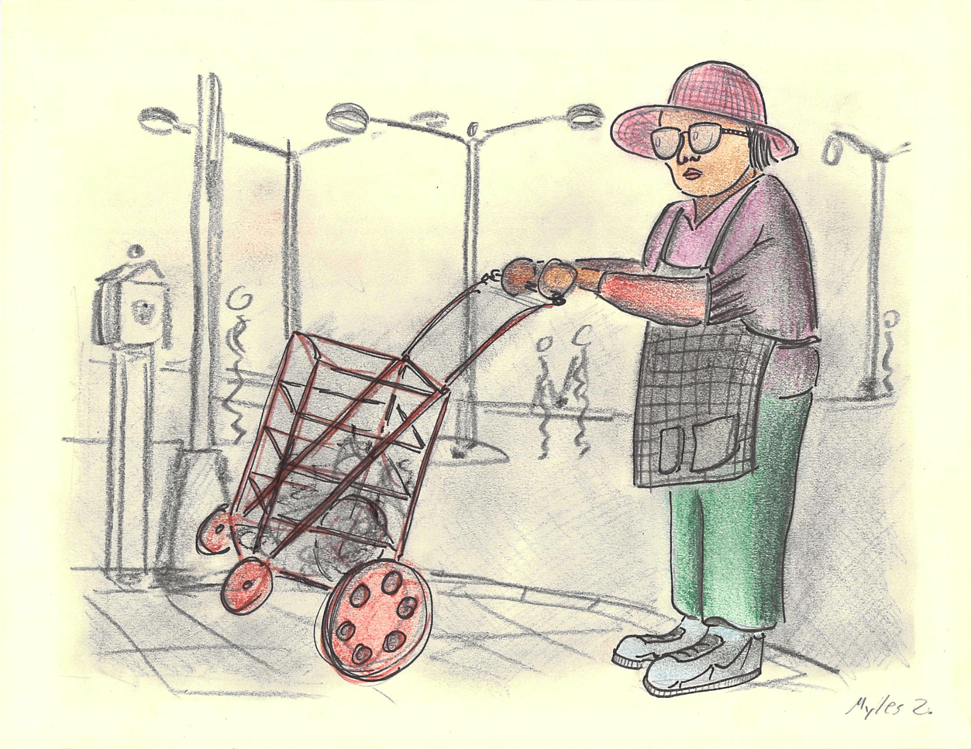
As you continue up Mott Street, notice the variety of produce stands, and fish and meat markets that spill out onto the sidewalk. Also notice the variety of food delivery trucks, handcarts, and boxed food waiting on the sidewalk to be unpacked. At some points, the sidewalk becomes so narrow from the food stands that the boundary between public and private dissolves.
Exploring the food systems that make up Chinatown’s markets is a major focus of CALL’s work in this neighborhood. After finishing the walk, you can check out more walking tours and projects from City as Living Lab.
13. A Mixed Use Neighborhood
Chinatown preserves a slice of urban life that has long since vanished from all other American cities. Before the modern laws of zoning and land use divided cities into zones of residential, commercial, and industrial, urban neighborhoods had diverse and mixed land uses. Food trucks unload onto the sidewalk while residents watch from tenements above. Bulk manufacturing noodle factories and lumber warehouses co-exist alongside the same restaurants that buy and use their products. The crowded tenements of urban laborers existed alongside the garment and industrial shops where they worked, such as the massive yellow-brick Mietz & Weiss Oil Engine Building on Mott Street that is now a supermarket. In immigrant New York, garment workers brought unfinished goods home with them to complete from crowded tenements like those that now surround you. As Jacob Riis wrote in 1890: “Nowhere in the world are so many people crowded together on a square mile as here.”
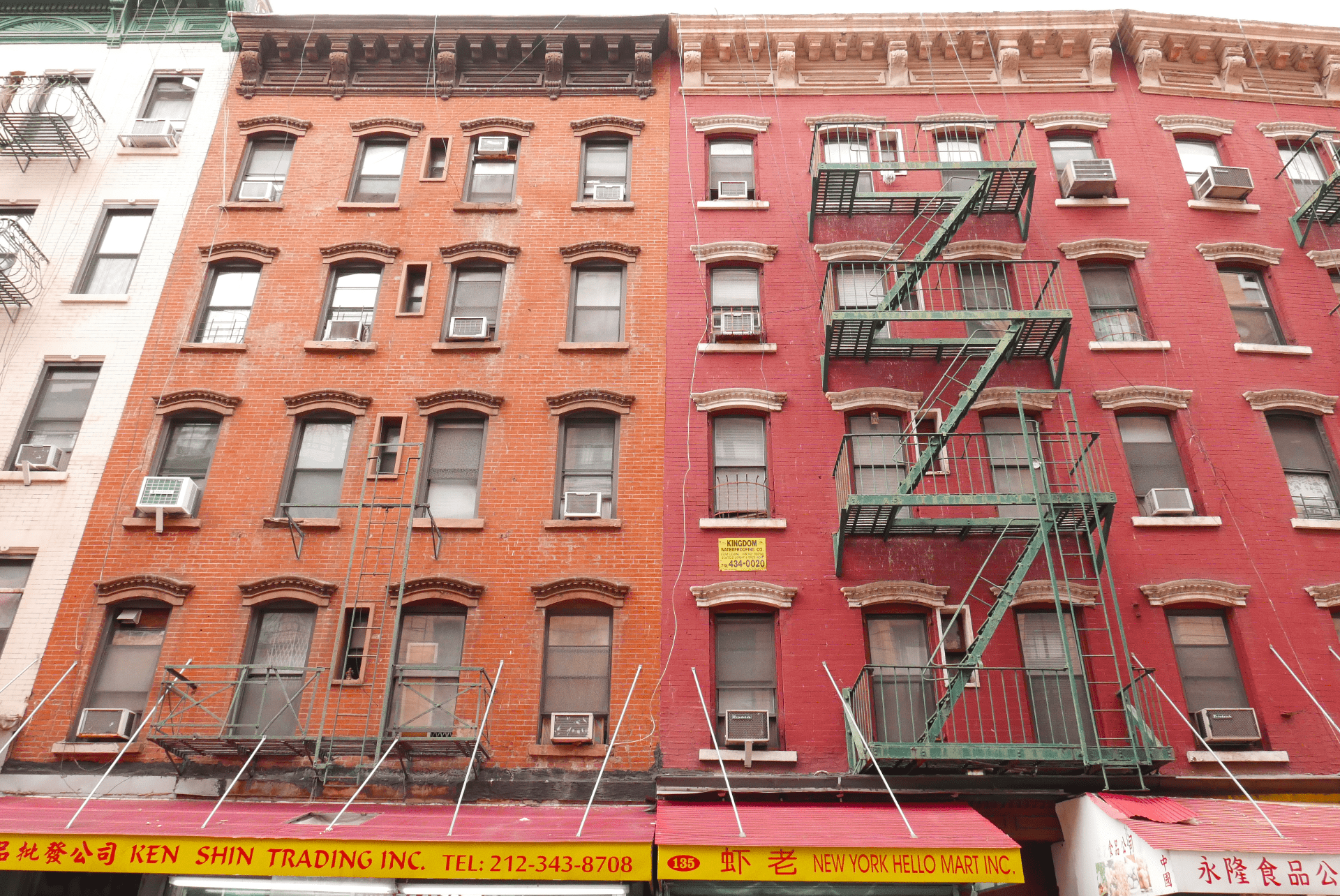
As you look up at the tenements on the left side of Mott Street, notice the floor of each tenement has four windows, and a tiny little window in the middle of each floor. These tenements from the mid to late nineteenth century originally contained about twenty apartments per building, often with sixteen people in a two-room apartment, with no running water and with shared latrines in the backyards. Showers and bathing required visits to the nearest public bathhouse or sponge baths from buckets. When later changes required indoor plumbing, bathrooms were carved out of the old tenements and the little rectangular windows were created on the middle of each floor you see today. Living conditions are less crowded and more sanitary than they were a century ago, but Chinese immigrants live in the same rooms that generations of Italians, Irish, Germans, Jews, Czechs, and Polish immigrants lived in before them.
Mott Street tenements
14. Leaving Mott Street
When you arrive at the intersection of Mott with Grand Street, turn right and walk two blocks to Bowery. After one block, you will spot the imposing limestone façade of the Bowery Savings Bank by the architectural firm McKim, Mead, & White.

Old Bowery Savings Bank
15. Old Bowery Savings Bank
When opened in 1894, it was the largest and most imposing building in the Lower East Side. The marble interior with gilded and paneled high ceilings was a statement of power, and an advertisement to the immigrant masses that the bank was a safe and permanent place to park their money. In late-nineteenth-century New York, immigrants could expect to earn around two dollars a day in sweatshops, construction, and food supply. Think of how many nickels and dimes in immigrant savings it must have taken to build the Bowery Savings Bank, or the dozens of churches and synagogues that line the streets of Chinatown

Chinatown street scenes
16. Back at the Bowery
At the intersection with Bowery, turn right. While only two blocks from the commerce of Mott Street, the character of Bowery is visibly different. Notice the range of furniture, lighting, and restaurant supply stores that line Bowery. Lack of storage space is a constant challenge for light industrial and supply businesses in Chinatown. Notice how some the kitchen supplies, stoves, or cookware for sale in some businesses spill out onto the sidewalk. Not only is Chinatown the center of New York City’s Chinese community, it is also the center of food supply and distribution for Chinese restaurants across the New York region. After two blocks, you will be back where you began.
As you watch the traffic edge through the triumphal arch of the Manhattan Bridge and into Chinatown, reflect on how the constant flow of immigrants have shaped and reshaped the city. Surviving in Lower Manhattan for almost 200 years, the Chinese have outlived and outgrown all other immigrant communities in Manhattan that have long since dispersed. Specific cultures and peoples have passed away, but the crowds of vibrant immigrant culture endure. Walt Whitman’s poetry is as alive today as when he wrote Crossing Brooklyn Ferry in 1856.
What is it then between us?
What is the count of the scores or hundreds of years between us?Whatever it is, it avails not—distance avails not, and place avails not,
I too lived, Brooklyn of ample hills was mine,
I too walk’d the streets of Manhattan island, and bathed in the waters around it,
I too felt the curious abrupt questionings stir within me,
In the day among crowds of people sometimes they came upon me,
In my walks home late at night or as I lay in my bed they came upon me.