No comments
Homesteads to Homelots in the Garden State
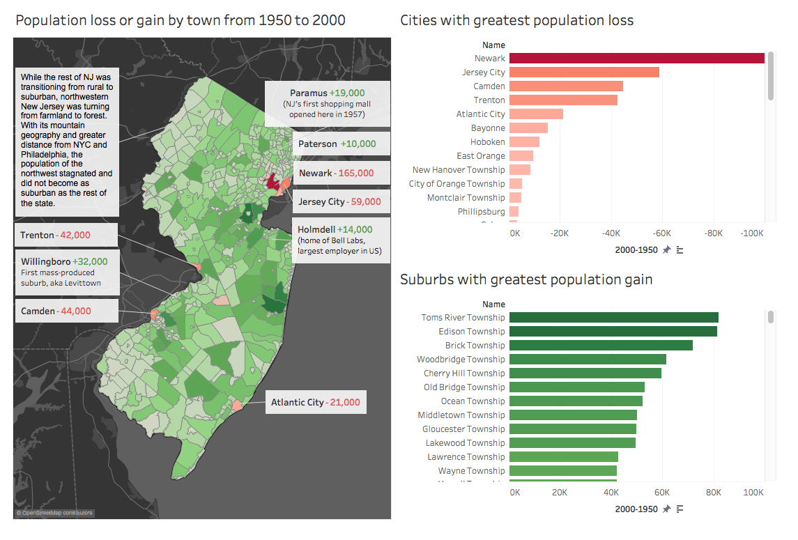
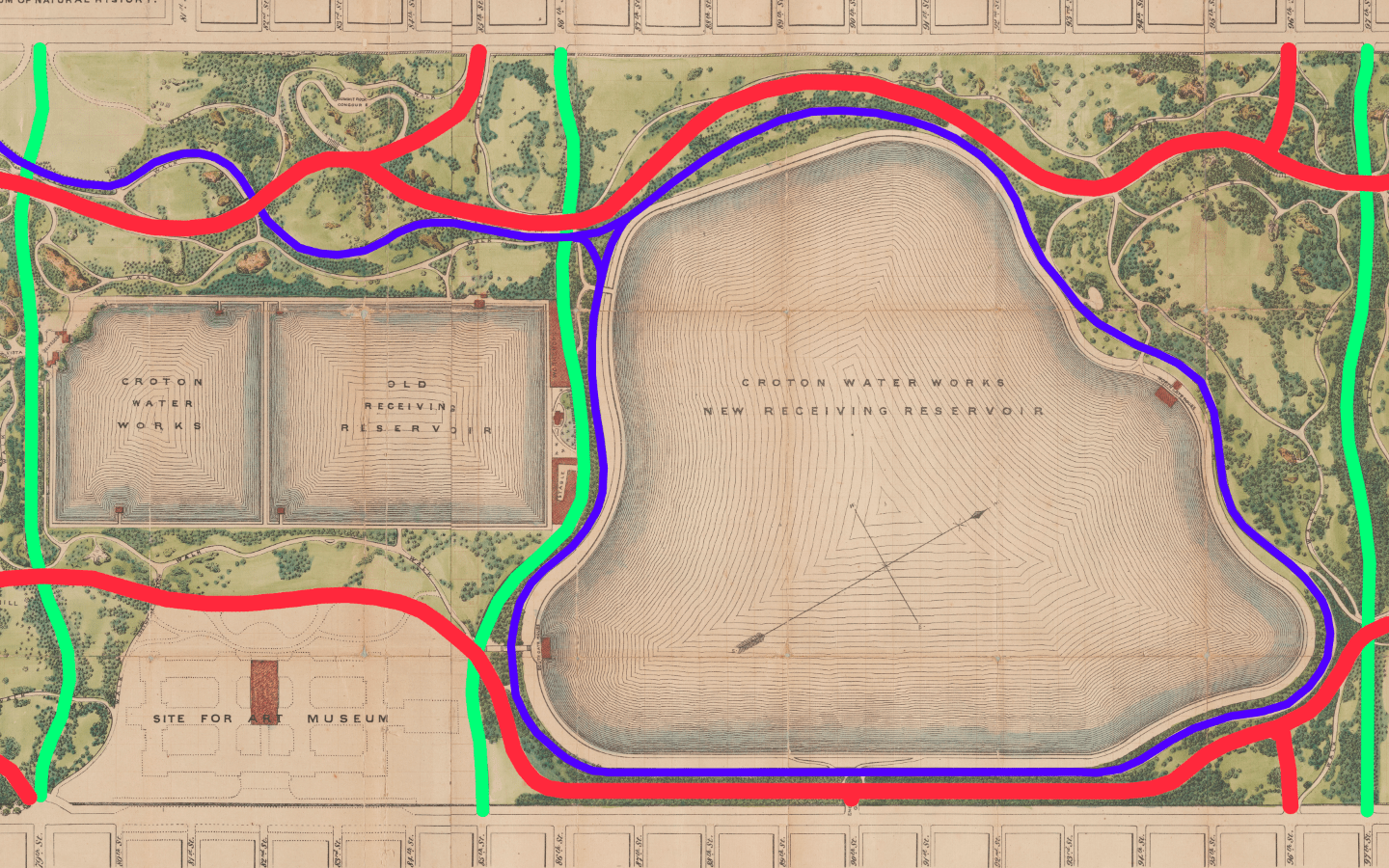
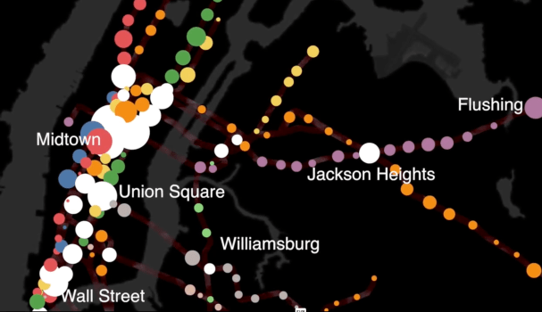
Analysis of US census data reveals spatial trends in New Jersey’s suburban sprawl from the 1920s to 2020s. NJ’s landscape evolved from an urban state in the 1920s to what is now a suburban state with diminished civic realm. This analysis uses data to explore municipal fragmentation, population density shifts, and enduring economic challenges. The state’s unique political geography causes persistently high property taxes and spatial inequality. NJ’s story reveals mirrors larger spatial patterns in American urban history. VIEW PUBLICATION >